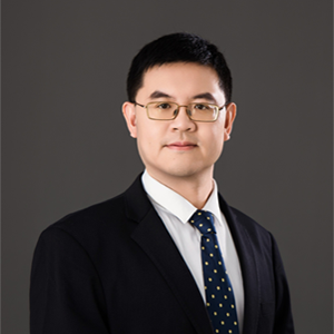
Ruopu Li
Faculty Fellow, Office of the Vice Chancellor for Research
Dr. Ruopu Li is a Professor and Graduate Program Director in the Geography and Environmental Resources program within the School of Earth Systems and Sustainability at Southern Illinois University Carbondale. He also serves as a Faculty Fellow in the Office of the Vice Chancellor for Research. Dr. Li earned his Ph.D. in Natural Resource Sciences from the University of Nebraska-Lincoln and is recognized for his leadership in geospatial science, artificial intelligence, and environmental systems research.
stems, integrating GIS, remote sensing, geospatial artificial intelligence, hydrologic modeling, and social science approaches to address complex environmental and societal challenges. His work explores water resources management, the food-energy-water nexus, smart and connected communities, social-environmental systems, and the application of emerging technologies to sustainability challenges.
Dr. Li has led numerous externally funded research projects and published extensively in leading interdisciplinary journals. Through his research, teaching, and mentorship, he prepares students to apply innovative geospatial and analytical tools to solve real-world environmental problems while advancing sustainable and resilient communities.
Education
Ph.D., University of Nebraska-Lincoln
M.S., Tianjin University
B.S., Nankai University
Selection Of Courses Taught
GEOG 401/502: Geographic Information Systems
GEOG 420/520: Advanced GIS Studies
GEOG 417/517: GIS Programming
Research Interests:
Dr. Li's research centers on the Geoinformatics for Food-Energy-Water (GeoFEW). His specific research topics include Water Resources Modeling and Management, Food-Energy-Water Nexus, Social-Hydrological Systems, Use-inspired Artificial Intelligence, and Smart and Connected Communities. His research methods involve geospatial artificial intelligence, social media data mining, multispectral drones, and community surveys.
Recent Publications
Edidem, M., R. Li*, D. Wu, B. Rekabdar, G. Wang. 2025. GeoAI-based Drainage Crossing Detection for Elevation-derived Hydrographic Mapping. Environmental Modelling and Software. 106338
Wu, D., R. Li*, M. Edidem, G. Wang. 2024, Enhancing Hydrologic LiDAR Digital Elevation Models: Bridging Hydrographic Gaps at Fine Scales. JAWRA Journal of the American Water Resources Association. 60(6), 1253-1269.
Chindia, B., R. Li*, L.A. Duram, J. Schoof, H. Henson, W. Williams. 2024. Navigating Barriers to Success for Community College Science Students: A Review of Transfer Challenges. Journal of Higher Education Theory and Practice 24(10), 149.
Nikolic-Khatatbeh, J., J. Crowe, R. Li*. 2024. Navigating Telehealth Challenges: Rural Perspectives on Technology Access and Trust. Journal of Rural and Community Development. 19(2), 167–180.
Crowe, J., J. Nikolic-Khatatbeh, R. Li*. 2024. The Digital Health Divide: Understanding Telehealth Adoption Across Racial Lines in Rural Illinois. Social Science & Medicine – Population Health. 26, 101665.
Chen, X., K. Chen, M. Wang, R. Li*, 2023. Roles of Wireless Networks in Bridging the Rural Smart Infrastructural Divide. Infrastructures. 8(11), 159.
Wu, D., R. Li*, C. Talbert, M. Edidem, B. Rekabdar, G. Wang. 2023. Classification of Drainage Crossings on High-resolution Digital Elevation Models: A Deep Learning Approach. GIScience & Remote Sensing. 60:1,
Wu, D., R. Li*, J. Liu, N. Khan. 2023. Monitoring Algae Blooms in Small Lakes Using Unmanned Aerial Vehicles: A Case Study in Southern Illinois. Journal of Contemporary Water Research & Education. 177.
Li, R.*, M.M. Rahaman, L. Zhao, Z. Tang. 2021. Assessing Social Media Communication of Local Governments in Fast-growing U.S. Cities. The Professional Geographer. 73(4), 702-712.
Bhadra, S., R. Li*, D. Wu, G. Wang, B. Rekabdar. 2021. Assessing the Roles of Anthropogenic Drainage Structures on Hydrologic Connectivity Using High-resolution Digital Elevation Models. Transactions in GIS. 25(5), 2596-2611.
Alam, S., M. Gebremichael, R. Li, J. Dozier, D. Lettenmaier. 2020. Can Managed Aquifer Recharge Mitigate the Groundwater Overdraft in California’s Central Valley? Water Resources Research 56(8), e2020WR027244.
Li, R.*, K. Chen, and D. Wu. 2020. Challenges and Opportunities to Cope with Smart Divide in Rural America. Annals of the American Association of Geographers 110(2), 559-570.
Crowe, J., R. Li*. 2020. Is the Just Transition Socially Accepted? Energy History, Place, and Support for Coal and Solar in Illinois, Texas, and Vermont. Energy Research & Social Science 59, 101309.
Recent Grants
PI, $174,768, Making Stressed Rural Communities' Climate-change Resilient with Locally Relevant Action-ready Information. 1/2025 – 4/2028. NASA (a subaward from George Mason University)
PI, $300,000, EAGER: CHIRRP: Responding to Groundwater Depletion and Building Resilience by Examining Emerging Social-Environmental-Technical Structures. 09/2024 – 08/2026. Co-PI: C. Quinn, K. Akamani, S. Hu. awarded by National Science Foundation.
PI, $1,333,329, Converging Earth Science and Sustainability Education and Experience to Prepare Next-Generation Geoscientists. 01/2023- 12/2027, Co-PIs: H. Henson, L. Duram, J. Schoof, W. Williams. awarded by National Science Foundation.
Co-PI, $201,262, Collaborative Research: CyberTraining: Pilot: Research Workforce Development for Deep Learning Systems in Advanced GPU Cyberinfrastructure. 12/2022-11/2024, PI: T. Shu, National Science Foundation.
Co-PI, $100,000, HAB Early Mitigation by Magnetic Photocatalysts (Stage II). 07/01/2022-06/30/2024, PI: J. Liu, awarded by U.S. Environmental Protection Agency.
PI, $278,812, EAGER: SAI: Bridging the Smart Divide in Rural America by Understanding the Interplay of ICTs and Social Infrastructures. 09/01/2021-8/31/2023, Co-PI: J. Crowe, K. Chen, National Science Foundation.
Co-PI, $24,991, HAB Early Mitigation by Magnetic Photocatalysts. 12/01/2020-11/30/2021, PI: J. Liu, U.S. Environmental Protection Agency.
Co-PI, $209,015, Using Multispectral Platforms to Manage Soybean Cyst Nematode. 09/01/2020-8/31/2023, PI: J. Bond, awarded by Illinois Soybean Association.
PI, $170,718, Enhancing High-resolution Terrain Data Model for Improving the Delineation of Multi-scale Hydrological Connectivity. 06/01/2010-11/30/2022, Co-PI: B. Rekabdar, G. Wang, National Science Foundation.
PI, $145,900, Characterization of Groundwater Recharge Dynamics in the Unsaturated Zone Using Hydrologic Models in the Central Platte River Basin. 06/01/2018-02/29/2020, CO-PI: Gengxin Ou, Central Platte Natural Resources District.